

Aqua Map Version 20, fast scrolling and new features

Aqua Map has already established itself as an excellent app for boaters supplying valuable data at your fingertips. But one weakness has been the relatively slow rendering of charts. This made scrolling slower than you would like, but now Aqua Map is out with version 20 and an all new charting engine. The result? Lightning fast scrolling and several nice updates to make one of the leading navigation apps even better.

Aqua Map has an impressive list of features to help make boating easier. It displays Active Captain Community and Waterway Guide crowd sourced data. The Master add-on displays Army Corps of Engineers survey data (the only app or marine hardware to do so), a WiFi connection to display depth, location and AIS, and Route Explorer to alert you to bridges, hazards, marinas and fuel along your route.
-

Aqua Map version 14 chart view -

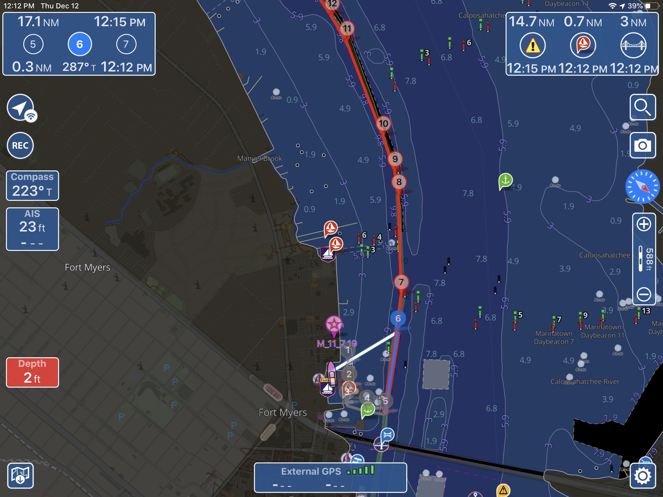
Aqua Map version 20 chart view
I’ve been very happy with Aqua Map’s functionality but never thought it was as visually pleasing as some of the other navigation apps available. I found some of the icons disproportionately large and the overall look not quite polished. Well, that’s all gone; the new charting display looks great and in my mind matches the level of polish of the other leading apps.
In previous versions scrolling frequently resulted in the chart view rendering one tile at a time. Depending on zoom level and the number of chart features this could result in significant lag.
With version 20 I’m yet to see any delay as I scroll around the charts. Though be warned the new version does require re-downloading all your charts so make sure you’re somewhere with good internet connectivity. The more elegant presentation of the charts and the dramatically faster rendering add up to a big upgrade for my use of Aqua Map.
-

MapXPan mode in version 14 -

Traditional view with offset -

Bird’s eye offset view in version 20
I prefer to view my charts with an offset — where the vessel is displayed towards the bottom of the screen so you see more of what’s ahead of you than what’s behind — but the previous versions of Aqua Map didn’t support this view. The closest they got was MapXPan mode that you can see on the left. This was supposed to render a three-dimensional view of your surroundings but I always found it an odd and distorted view and hence never used it. Now, Aqua Map version 20 automatically switches to an offset view when you set it to course or heading up mode. Additionally, you can take two fingers and swipe up and down on the screen to change from a straight on view like in the middle to more of a bird’s eye view as can be seen on the right.
Aqua Map has also added both automatic (with iOS) or manual (controlled in the app’s settings) switching between light mode and dark mode. It’s not a big deal but it’s just one more bit of polish that’s been added to what has become a pretty highly polished navigational app.
I still think of all navigation apps as supplements to installed, dedicated equipment, but I’m extremely happy with the apps available right now. In my opinion the two apps that distinguish themselves above an already capable field are Navionics and Aqua Map. Navionics still offers a few things Aqua Map doesn’t with their auto-routing and SonarCharts. Aqua Map also has a few features Navionics doesn’t, like ACOE surveys, route explorer and ability to display Waterway Guide POIs. This leads me to prefer two iPads at the helm with one running each app. And both apps start at just $15 a year for a subscription so you don’t have to pick just one.
The post Aqua Map Version 20, fast scrolling and new features appeared first on Sailfeed.