

Climbing Approach Trails and Gaia GPS
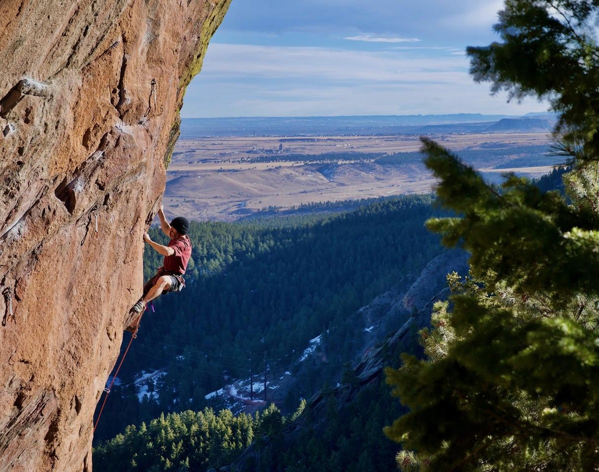
Unless your crag is roadside (looking at you, Rifle Mountain Park and Potash Road), you’re going to need to hike in. What typically happens with a new crag is, climbers at first take the path of least resistance—straight uphill, the classic “climbers’ trail.” Soon, this erodes or otherwise proves unsustainable, and then a braided network of social trails crops up as everyone tries to find their own, “best” way. Finally, the local climbing organization and/or a land manager have to step in and organize trail work before the eco-disaster proceeds any further. This is a particular problem of note around Boulder, Colorado, where in Rockies foothills the approaches to the cliffs are invariably up steep gullies and canyon walls.
A Solution to Social Trails?
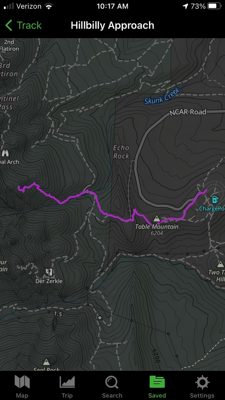
One solution we could all start applying, in addition to cairning the approaches, would be to mark the best approach on a shared map, as you can with the Gaia GPS app, which comes as part of an Outside+ membership. A local crag I’ve been going to, Hillbilly Rock in the Flatirons, is a perfect example. You leave the main hiking trail, the Mesa Trail, and from there follow a climber’s/scrambler’s trail up into Skunk Canyon, but once you’re in Skunk and need to crank up the steep canyon wall, there’s no one approach. Some folks take the east side of a big gully, heading to the moderate slabs on Hillbilly’s east face; some take the west side of the gully, which drops you off closer to the west face and its overhanging sport climbs; and some mix and match, which has created a braid-work of eroding social trails I’ve been trying to block off with deadfall and branches.
A Sample Approach
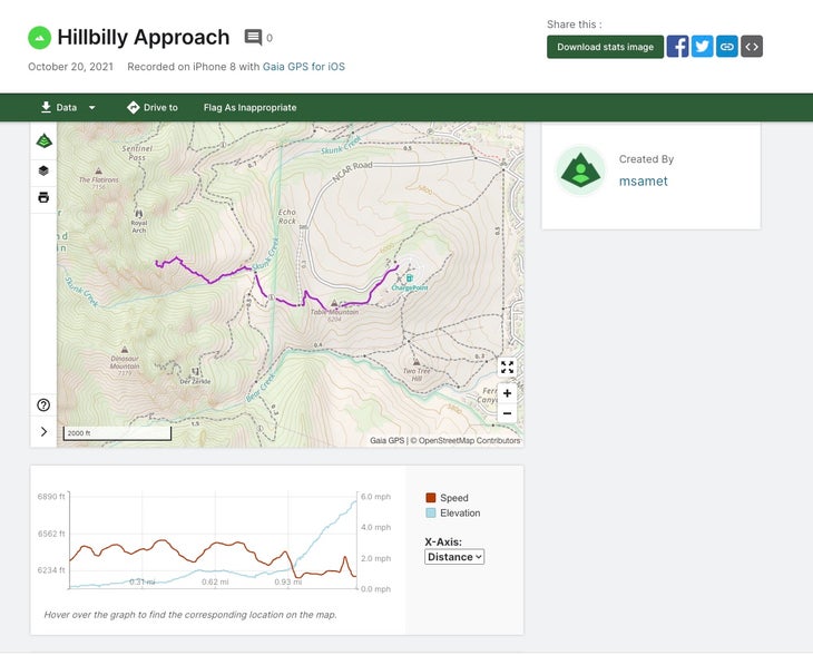
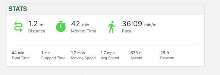
As an experiment, I tried using the Gaia GPS app to mark my approach to Hillbilly—the most-traveled route, on the gully’s east side, which the Flatirons’ land manager, Open Space and Mountain Parks, prefers we use until we can do some proper trail work. It was super simple: I just hit “Record” at the trailhead and then “Finish Track” at the crag, and I was done. The route was marked in a bright, visible line on the map, and I learned a few things from the data too: the approach, which I figured was about a mile long, is 1.22 miles. And what I thought was 1,000 feet of elevation gain was only 673 feet. Time to work on my cardio!
In any case, Gaia GPS is a tool I foresee using often in the future, to mark approaches to new or lesser-known crags or boulders for friends, and to share them with other climbers or with land managers in order to route climbers to the best, most sustainable approach to the cliffs.
So, if you’re wondering how to get to Hillbilly Rock—the proper way—the link is below. Enjoy!
https://www.gaiagps.com/public/MxZubRhfpGAtR35RTPNhrm88
The post Climbing Approach Trails and Gaia GPS appeared first on Climbing.